
Reality Capture: How drones, 3D laser scanners, point clouds, and more can benefit your project
By Eric Vallejo
One of the coolest parts of my job is that I get to play with a lot of “toys,” or tools, like drones and high-tech 3D laser scanners.
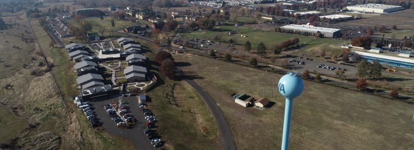
A couple examples include creating a 3D map of a large medical center campus in California (my team flew one of IMEG’s drones and mapped almost 200 acres in less than four hours) and, farther up the coast in the Northwest, flying our drones and conducting 3D scanning over several days to aid in a master plan development for a Veterans Administration medical center.
Today’s “reality capture” tools are a far cry from static aerial site photography, such as Google Earth, which doesn’t capture data. Using a combination of state-of-the-art drone and 3D laser scanning technology, however, we can capture an immense amount of data while also collecting current views of the site, the lay of the land, buildings, other structures, and infrastructure.
Here are several common reality capture technologies and related terminology:
- Drones: An unmanned aerial vehicle (UAV), commonly called a drone, is a component of an unmanned aircraft system (UAS), which includes a UAV, a ground-based controller, and a system of communications between the two. IMEG’s quadcopters are top-of-the line unmanned aircraft, and our pilots are certified under FAA Part 107. We can attach one of three different cameras to the drones to gather a crazy amount of information through photography and video.
- Photogrammetry: This is a rendering process that stitches together photographs captured by the drone cameras to create a continuous map or 3D model along with all associated data.
- Data points: These are the X, Y, and Z coordinates of any point in space based on a fixed reference location. These coordinates are the essential elements of every map or scan.
- 3D laser scanning: This process uses a laser and camera set at a fixed point or points to capture measurements (data points) of exterior structures or interior spaces to create a point cloud. 3D scanners come in handheld versions, tripod/rotating versions, and total station scanners that combine high accuracy measurements using traditional survey methods with 3D laser scanning – an ideal instrument for outdoor applications.
- Point cloud: A product of the data captured by 3D laser scanners and drones. (See video below.) Once data is registered and processed, it may be translated into a 3D model utilized for the basis of design, volumetric analysis (for stockpiles and quarries), or measurements – e.g., the distance and relative location between any two points, such as the distance between one utility and another, one corner of a building to another, or one end of an air handling unit to another.
- Lidar: Light detection and ranging is a sensor that can measure the amount of time laser light takes to hit an object and bounce back.
- Ground-penetrating radar (GPR): This uses radar pulses to locate underground utilities and structures.
- Subsurface utility engineering (SUE): This involves the use of multiple non-desctructive methods, such as GPR, to locate underground utilities horizontally and vertically.

As cool as the reality capture technology is, what we can do with it is even more impressive. For example, we can show owners a flyover of their proposed or in-progress site development, create a 3D map of large areas that would take days to map, and take highly accurate measurements of multiple buildings on a campus. We’ve even used our 3D laser scanners to measure the surface area of a water tower so the municipality would know how much paint would be needed to repaint it.
Our drone and 3D laser scanning services are not limited to civil projects. Basically, if we can see it, we can map it, so we work closely with our other disciplines, from structural to MEP, to create some incredible, information-rich models for clients in all markets. We can fly drones to provide exterior structural inspections; to provide 3D mapping of a space destined for renovation to determine where new infrastructure will fit; or scan an existing mechanical room to determine if it can accommodate the size and dimensions of a particular piece of new equipment.
The uses of 3D scanners and drones are endless, especially when used together. But the best part of using these technologies is the benefit to our clients. These include:
Time savings: An area that used to take days or weeks to manually map with a GPS or a traditional survey can now be flown and mapped in hours or a few days, depending on the size of the project. Less time spent surveying at a worksite translates to cost savings for clients and helps speed up the entire construction timeline.
Ease of access: Need to inspect the structure underneath a bridge section? Forget using a lift or floating in on a barge. Just fly a drone.
Increased data and accuracy: The immense amount of data captured is extremely accurate and is always available for future extrapolation for other projects. Once you have a point cloud of your site, roadway, or interior space, you can reference that information forever.
Safety: These tools allow for safer work environments for our surveyors and our clients’ personnel. No one needs to venture into any potentially dangerous situation when a drone is available.
There’s no doubt the applications of reality capture will continue to expand as enhanced and new tools emerge, particularly those that utilize AI-based software to move the technology forward.
That means more benefits for owners, and more toys for me.
Watch a 2-minute drone video that includes a 3D point cloud created from a recent VA medical center project.